 ™
™TRADITIONAL MOUNTAINEERING
™
www.TraditionalMountaineering.org
™ and also
www.AlpineMountaineering.org
™
™
FREE BASIC TO ADVANCED
ALPINE MOUNTAIN CLIMBING INSTRUCTION™
Home
| Information
| Photos
| Calendar
| News
| Seminars
| Experiences
| Questions
| Updates
| Books
| Conditions
| Links
| Search
![]()
Map, Compass and GPS navigation training Noodle in The Badlands
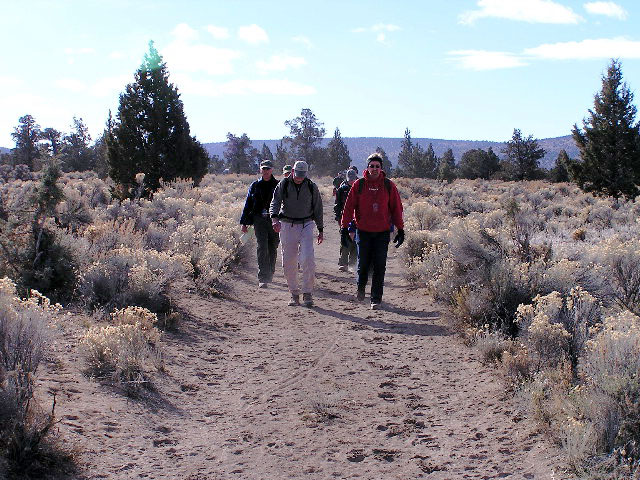
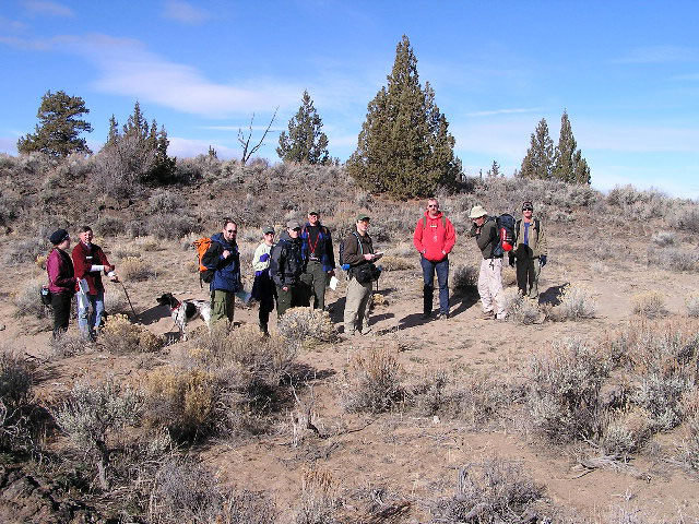
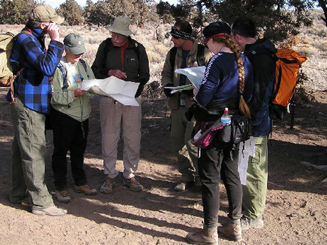
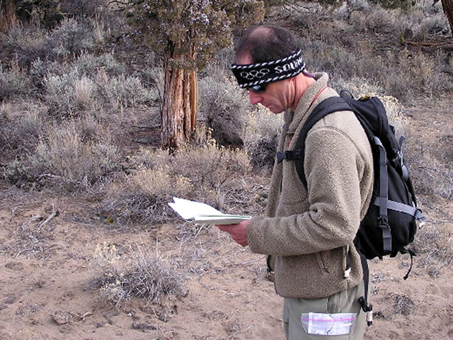
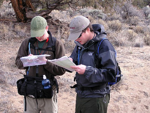
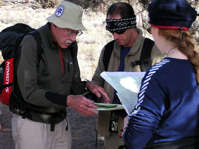
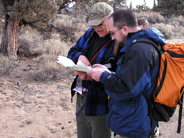
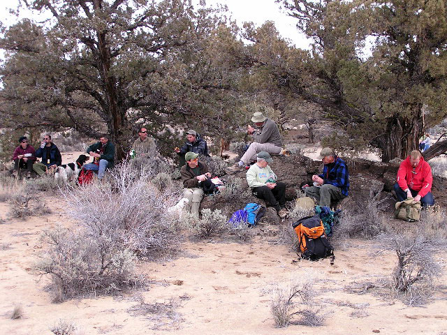
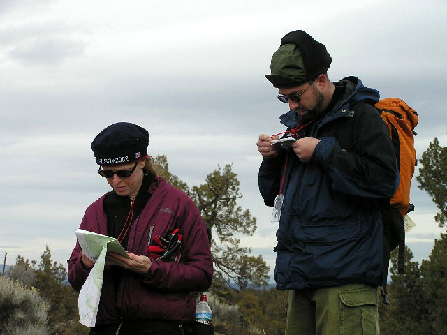
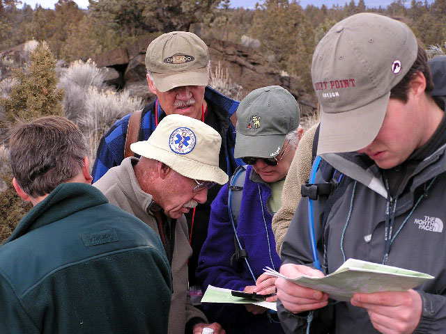
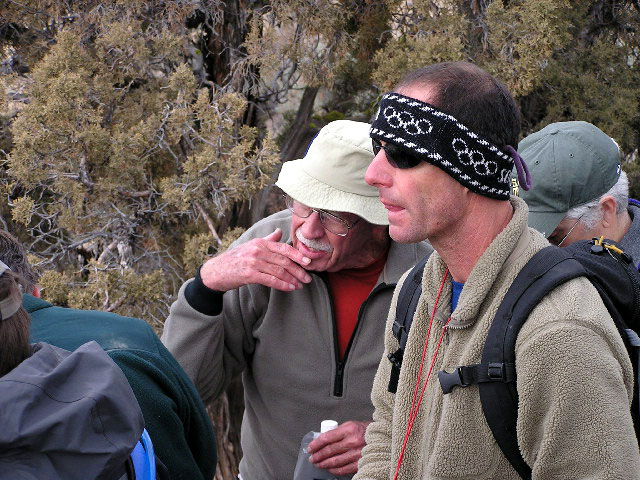
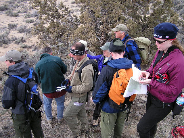
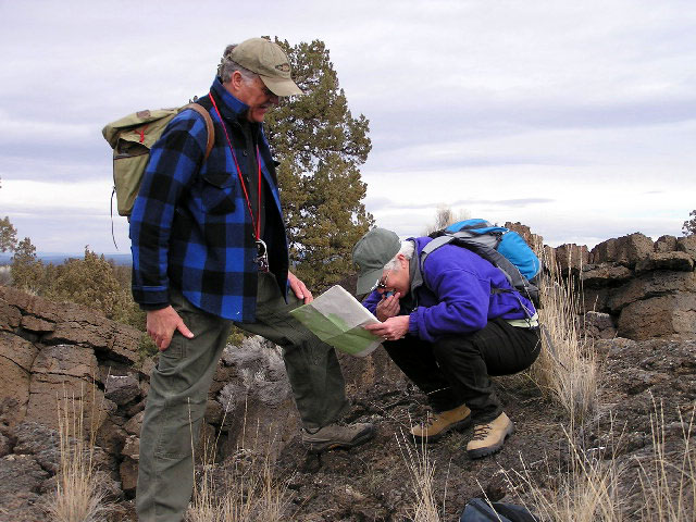
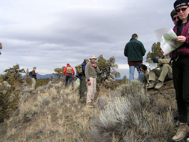
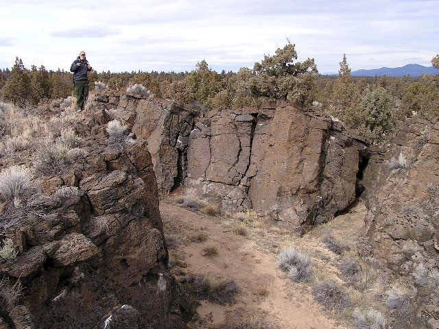
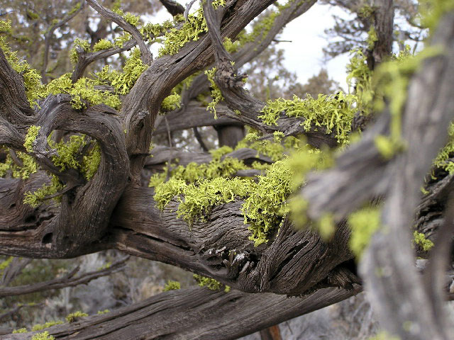
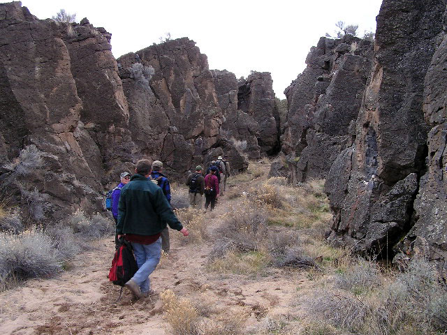
Photographs Copyright© 2005 by Michael Cardon. All Rights Reserved.
FROM OUR CALENDAR OF INTERESTING OUTDOOR EVENTS
Saturday, February 20, 2005, 9AM to 3PM, Bob's FREE Navigation Noodle®
in the Badlands, no matter what the weather!
This is a FREE field exercise for folks who have learned a bit about modern land
navigation techniques with map, compass and "optional" GPS. For photos of a previous Noodle go to http://www.traditionalmountaineering.org/Photos_Badlands_Noodle_sm.htm.
Jim Witty wrote about a Noodle for The Bulletin: http://www.traditionalmountaineering.org/News_Noodle.htm.
Limited to 10 people. You must Reserve a place!
Call Bob Speik at 385-0445 for your Reservation, the location of the meeting place and a detailed Prospectus.
COMPARISON OF 1:100,000 TO THE STANDARD 1:24,000 USGS QUAD TOPO MAP DETAIL
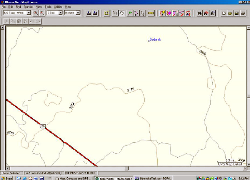
Shown above is a screen print of Garmin's MapSource computer program.
These maps are the only maps that can be uploaded to the Garmin GPS models.
The map scale (detail) is "comparable" to the USGS standard for 1:100,000 map
scale. The ten western states are contained on one CD.
Note that the program is set to the highest scale (detail).
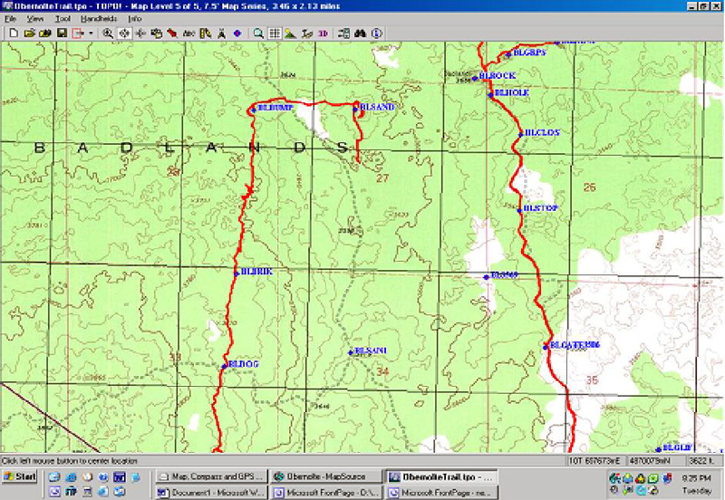
Shown above is a screen print from the $99.00 Maptech Terrain Navigator computer program for the State of Oregon.
This program offers exact copies of the base maps of the United States made by the USGS. These
maps are 1:24,000 map scale (detail).
(Eight CDs are needed to contain just the detail of the 1,900 Quad topo maps for the state of Oregon only!) We suggest you purchase the
$99.00 Map Tech Terrain Navigator program (shown here) or the $99.00
National Geographic TOPO program for your State and a simple $99.00 Garmin eTrex H and a $25.00 cable,
or a $175.00 Garmin Venture HC, if you need a
USB cable connection for your computer. The Venture HC has a base road map of the entire United States,
however you need to spend another $99.00 for the Garmin Map Source program which offers
up-loadable maps to your GPS two inch screen at less than 1:100,000 detail.
Don't forget the declination adjustable base plate compass $30.00 Suunto M3 and the skills to use these together!
![]()
![]()
![]()
![]() WARNING - *DISCLAIMER!*
WARNING - *DISCLAIMER!*
Mountain climbing has inherent dangers that can, only in part, be mitigated
Read more . . .
Lessons learned from the latest lost Mt. Hood climbers
SPOT Satellite Messenger "PLB" reviewed and recommended
How do GSM mobile phones assist mountaineering and backcountry rescues?
Clinic on Real Survival Strategies and Staying Found with
Map, Compass and GPS together
What do you carry in your winter day and summit pack?
Why is the GSM digital cell phone best for backcountry and mountaineering?
What is a PLB or Personal Locator Beacon?
Why are "Snow Caves" dangerous?
Why are "Space Blankets" dangerous?
Why are "Emergency Kits" dangerous?
How can you avoid Hypothermia?
Missing climbers on Mount Hood, one dies of exposure, two believed killed in fall
Missing California family found, dad dies from exposure and hypothermia
Missing man survives two weeks trapped in snow-covered car
Missing snowmobile riders found, Roger Rouse dies from hypothermia
Olympic Champion Rulon Gardner lost on snowmobile!
Lost Olympic hockey player looses feet to cold injury
Expert skier lost five days near resort in North Cascades
without map, compass, gps or cell phone
Mount Hood - The Episcopal School Tragedy
Mount Hood - experienced climbers rescued from snow cave
How can you learn the skills of snow camping?
Prospectus
![]() Lost and Found
Lost and Found
Three climbers missing on Mt. Hood, all perish
Missing California family found, dad dies from exposure and hypothermia
Missing man survives two weeks trapped in snow-covered car
Missing snowmobile riders found, Roger Rouse dies from hypothermia
Longacre Expeditions teen group rescued from the snowdrifts above Todd Lake
Lost climber hikes 6.5 miles from South Sister Trail to Elk Lake
Hiking couple lost three nights in San Jacinto Wilderness find abandoned gear
Expert skier lost five days in North Cascades without Essentials, map and compass
Climber disappears on the steep snow slopes of Mount McLaughlin
Hiker lost five days in freezing weather on Mount Hood
Professor and son elude search and rescue volunteers
Found person becomes lost and eludes rescuers for five days
Teens, lost on South Sister, use cell phone with Search and Rescue
Lost man walks 27 miles to the highway from Elk Lake Oregon
Snowboarder Found After Week in Wilderness
Searchers rescue hiker at Smith Rock, find lost climbers on North Sister
Girl Found In Lane County After Lost On Hiking Trip
Search and rescue finds young girls lost from family group
Portland athlete lost on Mt. Hood
Rescues after the recent snows
Novice couple lost in the woods
Broken Top remains confirmed as missing climber
Ollalie Trail - OSU Trip - Lost, No Map, Inadequate Clothing
![]() Your Essential Light Day Pack
Your Essential Light Day Pack
What are the new Ten Essential Systems?
What does experience tell us about Light and Fast climbing?
What is the best traditional alpine mountaineering summit pack?
What is Light and Fast alpine climbing?
What do you carry in your day pack?
Photos?
![]()
What do you carry in your winter day pack?
Photos?
![]()
What should I know about "space blankets"?
Where can I get a personal and a group first aid kit?
Photos?
![]() Carboration and Hydration
Carboration and Hydration
Is running the Western States 100 part of "traditional mountaineering"?
What's wrong with GORP?
Answers to the quiz!
Why do I need to count carbohydrate calories?
What should I know about having a big freeze-dried dinner?
What about carbo-ration and fluid replacement during traditional alpine climbing?
4 pages in pdf
![]()
What should I eat before a day of alpine climbing?
![]() About Alpine Mountaineering:
About Alpine Mountaineering:
![]() The Sport of Alpine Mountaineering
The Sport of Alpine Mountaineering
![]() Climbing Together
Climbing Together
![]() Following the Leader
Following the Leader
![]() The Mountaineers' Rope
The Mountaineers' Rope
![]() Basic Responsibilities
Basic Responsibilities
![]() Cuatro Responsabiliades Basicas de Quienes Salen al Campo
Cuatro Responsabiliades Basicas de Quienes Salen al Campo
![]() The Ten Essentials
The Ten Essentials
![]() Los Diez Sistemas Esenciales
Los Diez Sistemas Esenciales
![]() Our Leader's Guidelines:
Our Leader's Guidelines:
![]() Our Volunteer Leader Guidelines
Our Volunteer Leader Guidelines
![]() Sign-in Agreements, Waivers and Prospectus
This pdf form will need to be signed by you at the trail head
Sign-in Agreements, Waivers and Prospectus
This pdf form will need to be signed by you at the trail head
![]() Sample Prospectus
Make sure every leader tells you what the group is going to do; print a copy for your "responsible person"
Sample Prospectus
Make sure every leader tells you what the group is going to do; print a copy for your "responsible person"
![]() Participant Information Form
This pdf form can be printed and mailed or handed to the Leader if requested or required
Participant Information Form
This pdf form can be printed and mailed or handed to the Leader if requested or required
![]() Emergency and Incident Report Form
Copy and print this form. Carry two copies with your Essentials
Emergency and Incident Report Form
Copy and print this form. Carry two copies with your Essentials
![]()
![]() Participant and Group First Aid Kit
Print this form. Make up your own first aid essentials (kits)
Participant and Group First Aid Kit
Print this form. Make up your own first aid essentials (kits)
![]()
![]() About our World Wide Website:
About our World Wide Website:
![]() Information
Information
![]() Mission
Mission
![]()
![]() Map, Compass and GPS
Map, Compass and GPS
Map, compass and GPS navigation training Noodle in The Badlands
BLM guidelines for Geocaching on public lands
Geocaching on Federal Forest Lands
OpEd - Geocaching should not be banned in the Badlands
Winter hiking in The Badlands WSA just east of Bend
Searching for the perfect gift
Geocaching: What's the cache?
Geocaching into the Canyon of the Deschutes
Can you catch the geocache?
Z21 covers Geocaching
Tour The Badlands with ONDA
The art of not getting lost
Geocaching: the thrill of the hunt!
GPS in the news
A GPS and other outdoor gadgets make prized gifts
Wanna play? Maps show you the way
Cooking the "navigation noodle"
![]()