 ™
™ ™
™
FREE BASIC TO ADVANCED
ALPINE MOUNTAIN CLIMBING INSTRUCTION™
Home
| Information
| Photos
| Calendar
| News
| Seminars
| Experiences
| Questions
| Updates
| Books
| Conditions
| Links
| Search
![]()
Gray Butte will take your breath away!

Gray Butte will take your breath away
The Bulletin
By Jim Witty
March 21, 2001
Part of the joy of hiking is sharing the outdoors experience with
other like-minded people.
Hiking partners and the stimulating conversation they can bring to the trail
help melt away the miles and ease the burn on those grueling uphill sections.
And sometimes they’ll share their lunch.
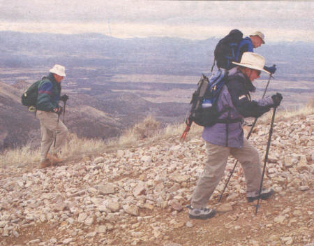
Matching strides with three able-minded hiking companions during a recent grunt
to the top of Gray Butte helped cut the 5,108-foot cinder cone down to a
manageable size. One’s a retired architect. Another’s a successful entrepreneur.
The third is Central Oregon’s original techno-ranger, Bill Gates in lederhosen.
The conversation ranges from growth in Central Oregon (what’s a body to do?) to
trailside nutrition (carbs not fat) to climbing Everest (you don’t do it for the view).
Before you know it, you’ve bagged another Central Oregon peak.
Gray Butte is no Everest. There’s a road of sorts to the top and an array of
communications towers once you get there. The view, however, is every bit as
breathtaking as the climb. Your trudge is rewarded by a panoramic 360-degree
view of all the region’s significant geographic features.
There’s Grizzly Mountain, Haystack Reservoir, the Crooked River National
Grassland and the Cascades chain standing in vivid relief to the west.
The high altitude perspective provides fodder for future adventures. Black
Butte’s a great hike once the snow’s off the trail. A circumnavigation of the
Three Sisters would be good fun ... So many hikes, so little time.
Below us, beneath the west flank of Gray Butte, is a historic grove of fruit
trees in barren winter phase.
The McCoin Orchard was planted in 1886 by Julius and Sarah McCoin and was
privately owned until the 1930s when the government bought the land. (It’s now
owned by the United States Forest Service.) The McCoin Orchard and another up
the road still bear fruit.
Just south of the apple and plum trees is a gravel parking area and the Gray
Butte Trailhead. This trail follows a ridge to the spot we’re standing.
After lunch and a few pictures, it’s back down the way we came. While the uphill
is a slog — especially the last mile or so, which is quite steep — the downhill
comes with its own distinct challenge.
Scree (loose chunks of rock) litters the road, making every step a little
adventure. Hiking poles prove stabilizing on this stretch of trail.
At the saddle, the walk gets easier and hikers are afforded
another nice view, this one to the back side of the Smith Rock area. But there’s
another, less-pleasing, sight here as well. Bullet-riddled cans and cardboard
beer cases mar the trail.
The descent done, we hop into one of the vehicles and follow Forest Road 5710
(Skull Hollow) around to the back side of Gray Butte.
There we encounter McCoin’s old homestead from a different angle and eye the
Gray Butte Trailhead with a future Friday in mind.
Then it’s back into town for a hot bath and a cold beverage, the empty placed in
a proper receptacle.
They give a nickel for empty pop cans, you know.
![]()
Get this paper delivered every day!
![]()
FREE SEMINARS
Map, compass and GPS navigation training Noodle in The Badlands
Snow climbing training with Mountain Link
Ice axe self belay and self arrest seminar
Traditional snow climbing training: snow anchors and rappels
Glacier travel and crevasse rescue seminar
Bend High invites an old traditional mountain climber
A Navigation Noodle in the Badlands with ONDA
A free guided tour of The Badlands with ONDA
Wilderness Navigation Noodle Seminar
A Sunriver thank you
GEOCACHING
Geocaching introduced to Central Oregon in 2002
I-Butte Cache on the summit of Black Butte
Geocaching the Top of Black Crater
Belknap Crater in the Mt. Washington Wilderness
Tam McArthur Rim
Geocaching into the Hole of Inaccessibility
Three Buttes Cache
Trail to Flat Iron in The Badlands near Bend
Picnic at Hanging Rock above Smith Rock
Geocaching with Z21 News with Molly Graham in the high desert
The Badlands Wilderness
Wilderness workshop for USDA Forest Service held by University of Idaho
BLM's final UDRMP opens Bend's Badlands to Geocaching
BLM's final UDRMP closes Bend's Badlands WSA to motorized vehicle use
BLM's UDRMP plans for Badlands deal with exploding public use
Map, compass and GPS navigation training Noodle in The Badlands
Deschutes County Commissioners fail to support Badlands Wilderness!
Deschutes County takes no position on Badlands Wilderness
Deschutes County Commissioner DeWolf supports Badlands Wilderness
OpEd - Dirt road through The Badlands must close
Photos of Road 8 damage sent to Commissioners
Badlands Wilderness with a road?
The Badlands have unique interest for the hiker
BLM guidelines for Geocaching on public lands
Geocaching on Federal Forest Lands
OpEd - Geocaching should not be banned in the Badlands
Fee Demo groundwork may save Geocaching on our public lands
Protest of exclusion of Geocaching in Badlands WSA in BLM's UDRMP
BLM's UDRMP puts Bend's Badlands off limits to Geocaching
Deschutes County Commissioners hearing on Badlands Wilderness support
OHV use restricted in Upper Deschutes Resource Management Plan
Winter hiking in The Badlands WSA just east of Bend
Tread Lightly OHV USFS tip of the month
OHVs to be held to designated trails by USDA Forest Service!
New pole shows Badlands Wilderness favored by voters
BLM posts Reward for information on Juniper rustlers
BLM weighing public input on management plan
Oregon's Badlands hit by old growth Juniper rustlers
Photos